Hanoi zoning map
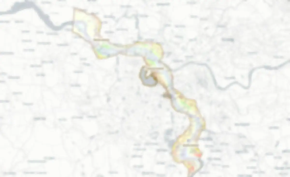
The government’s own plan drawings, placed on the map, with what is being built now. Tap or click anywhere on a plan to read it.
Approved by the cityDraft shown for comment, not approvedBeing built work under wayWhat the other labels mean
Checked 31 Oct 2026Read about each plan
Guide
What each plan means
Everything on the map above, written out: what each plan is, how far along it is, and where we read it. Tick a layer in the bar under the map to show it, or tap a plan to read about it there.
How to read this map
These are the government’s own plans, drawings and announcements, placed on the map by us. The city’s zone plans are drawn from the city’s own data, plot by plot. The Red River draft is redrawn by us block by block from its full-size drawings, with its planned roads left as gaps, within about 20 m of the real streets. A draft is shown for comment and can change before it is approved. Where a place is approximate, we say so.
Each plan carries one of these labels:
- Approved approved by the city
- Draft shown for comment, not approved
- Being planned plans being drawn up, some broadly agreed by the city; not final, no start date
- Starting 2026 the city says work starts in 2026
- Being built work under way
This is general information, not planning, legal or financial advice. Before you buy, or sign a long lease beside one of these plans, check the official plan for that address with the city. Facts checked 31 Oct 2026.
City zone plans Approved
The zone plans the city has approved, plot by plot, as the city’s own planning information system publishes them. Each coloured shape is one plot of land in a plan, with the use the plan gives it, drawn from the city’s data corner for corner rather than redrawn. The map holds 22,214 plots in 28 plans. Every plot is coloured by its use. Zoom in close and tap one for its use, its height limit where the plan sets one, and the plan it is in; further out, a tap opens the plan.
Each colour on the map is one group of the plans’ land uses:
- Homes (Đất ở): Homes kept and improved, and new homes.
- Villages (Đất làng xóm, đất ở nông thôn): Villages and rural homes, kept and improved.
- Mixed use, shops and services (Đất hỗn hợp, thương mại, dịch vụ): Shops, hotels and offices, often with homes.
- Schools and public buildings (Đất công cộng, trường học, y tế, di tích, tôn giáo): Health, public services, heritage and worship.
- Offices, government and embassies (Đất cơ quan, trụ sở, ngoại giao): Government offices, colleges and embassies.
- Green space, parks and farms (Đất cây xanh, TDTT, nông nghiệp): Parks, sport, buffer green and farmland.
- Rivers, lakes and ponds (Mặt nước): Rivers, lakes, ponds and canals.
- Transport, utilities and industry (Đất giao thông, hạ tầng kỹ thuật, công nghiệp): Stations, car parks, utility works and factories.
- Police and military (Đất an ninh, quốc phòng): Police and military land.
- Other land (Đất khác): Local reserves and green-belt projects.
The plans, by the city’s own code:
- A6, West Lake and its surrounds (the former Tây Hồ district). At 1:2,000, approved by the city on 8 August 2014 (Decision 4177/QĐ-UBND). 418 plots.
- GN, The northern green belt: Mê Linh, Đông Anh and Gia Lâm. At 1:5,000, approved by the city on 5 January 2015 (Decision 06/QĐ-UBND). 772 plots.
- GN(A), Part of the northern green belt: Cổ Loa, Đông Hội, Xuân Canh and Mai Lâm. At 1:5,000, approved by the city. 74 plots.
- GN(B), Part of the northern green belt: Xuân Nộn, Uy Nỗ, Việt Hùng and Liên Hà. At 1:5,000, approved by the city on 27 November 2015 (Decision 6500/QĐ-UBND). 79 plots.
- GS, The south-western green belt: Từ Liêm, Hà Đông and Hoàng Mai. At 1:5,000, approved by the city on 13 August 2015 (Decision 3976/QĐ-UBND). 2,138 plots.
- GS-A, Part of the green belt in Thanh Trì, by the Red River. At 1:5,000, approved by the city on 2 December 2015 (Decision 6633/QĐ-UBND). 382 plots.
- H1-1A, The Old Quarter. At 1:2,000, approved by the city on 19 March 2021 (Decision 1361/QĐ-UBND). 292 plots.
- H1-1B, Hoàn Kiếm Lake and its surrounds. At 1:2,000, approved by the city on 19 March 2021 (Decision 1360/QĐ-UBND). 112 plots.
- H1-1C, Hoàn Kiếm, round the Old Quarter and the lake. At 1:2,000, approved by the city on 19 March 2021 (Decision 1357/QĐ-UBND). 408 plots.
- H1-2, The former Ba Đình district. At 1:2,000, approved by the city on 19 March 2021 (Decision 1359/QĐ-UBND). 770 plots.
- H1-4, The former Hai Bà Trưng district, inside the second ring road. At 1:2,000, approved by the city on 19 March 2021 (Decision 1358/QĐ-UBND). 775 plots.
- H2-1, Parts of Tây Hồ, Cầu Giấy and Nam Từ Liêm. At 1:2,000, approved by the city. 1,462 plots.
- H2-2, Parts of Cầu Giấy, Thanh Xuân, Hà Đông and Nam Từ Liêm. At 1:2,000, approved by the city. 1,459 plots.
- H2-3, Parts of Thanh Xuân, Hoàng Mai, Hà Đông and Thanh Trì. At 1:2,000, approved by the city on 3 December 2015 (Decision 6665/QĐ-UBND). 1,529 plots.
- H2-4, Parts of Hai Bà Trưng, Hoàng Mai, Thanh Xuân and Thanh Trì. At 1:2,000, approved by the city on 27 November 2015 (Decision 6499/QĐ-UBND). 1,379 plots.
- N1, Mê Linh, round Quang Minh. At 1:2,000, approved by the city on 26 February 2013 (Decision 1911/QĐ-UBND). 1,305 plots.
- N10, Long Biên. At 1:2,000, approved by the city on 21 November 2014 (Decision 6115/QĐ-UBND). 1,883 plots.
- N2, Mê Linh, round Quang Minh and Chi Đông. At 1:2,000, approved by the city. 114 plots.
- N3, Mê Linh and Đông Anh, round Tiền Phong and Nam Hồng. At 1:2,000, approved by the city. 313 plots.
- N4, Đông Anh, round Đại Mạch, Võng La, Kim Chung and Hải Bối. At 1:5,000, approved by the city on 22 October 2012 (Decision 4761/QĐ-UBND). 663 plots.
- N6, Đông Anh, round Nguyên Khê, Xuân Nộn and Thụy Lâm. At 1:5,000, approved by the city on 2 December 2015 (Decision 6600/QĐ-UBND). 138 plots.
- N7, Đông Anh, round Bắc Hồng, Vân Nội, Uy Nỗ and Cổ Loa. At 1:5,000, approved by the city on 25 May 2012 (Decision 2270/QĐ-UBND). 738 plots.
- N8, Đông Anh, round Vĩnh Ngọc, Tàm Xá, Xuân Canh and Cổ Loa. At 1:5,000, approved by the city on 25 May 2012 (Decision 2271/QĐ-UBND). 307 plots.
- N9, Gia Lâm and Đông Anh, round Yên Viên and Phù Đổng. At 1:5,000, approved by the city on 9 January 2013 (Decision 165/QĐ-UBND). 1,032 plots.
- S2, Parts of Từ Liêm, Hoài Đức and Đan Phượng. At 1:5,000, approved by the city. 549 plots.
- S3, Hoài Đức and Hà Đông, round An Khánh and Dương Nội. At 1:5,000, approved by the city on 1 July 2013 (Decision 4324/QĐ-UBND). 802 plots.
- S4, Hà Đông. At 1:5,000, approved by the city. 1,434 plots.
- S5, Thanh Trì, round Ngọc Hồi. At 1:5,000, approved by the city. 887 plots.
Read from the city’s planning information system on 2 November 2026. The city may have changed a plan locally since it was approved, and such changes may not be shown. Check with your ward before relying on one plot. Source: Hanoi planning information system (quyhoach.hanoi.gov.vn), the city’s zone plans.
Red River riverside Draft
About 40 km of riverbank, from Hồng Hà bridge to Mễ Sở bridge, on both banks. Buildings up to 30 to 45 storeys in the new areas, with the villages kept and improved for now; one 109-storey tower is proposed, with no exact site or date, and the draft puts a landmark tower in the central stretch, tied to the West Lake to Cổ Loa axis.
Shown for comment from 7 to 26 Sep 2026. On 30 Sep 2026 the city cancelled the brief the draft was drawn under, and the plan is being redone, so the final version may differ. Nothing in it is approved.
The draft marks which zones come first and which are long term; the map shows both the same way. Each colour on the map is one group of the draft’s uses:
- New homes (Nhóm nhà ở mới): New apartment blocks and housing areas.
- Shops and services, some with homes (Dịch vụ; hỗn hợp nhà ở và dịch vụ): Housing mixed with shops and services; shops and services.
- Villages to be upgraded (Làng xóm cải tạo, chỉnh trang): Existing villages, kept and improved for now.
- Schools, health and culture (Trường học, y tế, văn hóa): Schools and kindergartens, health, culture, public facilities, heritage and religious sites.
- Parks, green space and sport (Cây xanh, công viên, thể thao): Public parks, themed parks, restricted and working green space, sport.
- River and lakes (Sông, hồ): River and canals; lakes and ponds.
- Ports, utilities and industry (Cảng, hạ tầng, công nghiệp): Other infrastructure (river ports, depots); industry and warehouses.
The draft divides the river into three stretches:
- North stretch, Hồng Hà bridge to Thăng Long bridge: 3,436 ha, planned for 160,000 people. Mostly kept natural: parks, sport and green space, with new homes, shops and services at Mê Linh, Thiên Lộc and Thượng Cát, and a cluster of river ports at Chèm.
- Central stretch, Thăng Long bridge to Thanh Trì bridge: 4,548 ha, planned for 541,000 people. The centre of the plan, called the city’s “living room”: culture, shops, finance and new homes on both banks, linking West Lake to Cổ Loa.
- South stretch, Thanh Trì bridge to Mễ Sở bridge: 3,435 ha, planned for 499,000 people. Trade, services, river ports and farm-and-eco tourism, with the craft villages such as Bát Tràng kept.
Sources: Hanoi Urban Planning Institute, draft Red River plan shown for comment, Sep 2026; Tiền Phong, 9 Sep 2026: the three stretches, their areas, people and heights, from the draft’s own text; Tiền Phong, 6 Sep 2026: the 109-storey tower proposed in the draft; CafeF, 5 Oct 2026: the brief for the Red River plan cancelled.
Hoàn Kiếm and West Lake upgrades
Hoàn Kiếm Lake area Draft
A draft change to the plan for the lake and the streets round it: bigger squares, a museum quarter, walking streets, and a new city government building. It covers 65.89 ha round the lake and was shown for comment in September 2026. On 28 October 2026 the city council approved the investment for the first works: clearing about 30.8 ha, a shopping centre four levels underground beneath the east and north squares, and a new city government building, due to be finished in 2029. Boundary drawn from the streets the draft names, so it is approximate.
- 1. Bigger square and a gateway. Đông Kinh Nghĩa Thục Square, at the north end of the lake, would be enlarged, with a gateway closing the Old Quarter axis.
- 2. Squares and the city government block. Squares and parks round Lý Thái Tổ garden and the Post Office, and underground space linked to metro Line 2 station C9. The city government block would be replaced by a 9-storey building with 4 basements; the city council approved the money for it on 28 October 2026.
- 3. Museum quarter and a finance tower. The National History Museum and the old Revolution Museum would become one complex, with a new International Finance Tower on the old museum site.
- 4. Walking street and a hotel. Nhà Thờ street would run on to the lake as a walking street; a high-end hotel on the Hà Nội Mới newspaper and 2 Tràng Thi sites.
West Lake and its shore Being built
A 13.5 km road along the lake is being rebuilt, without taking homes: Nguyễn Đình Thi, Trích Sài, Vệ Hồ, Nhật Chiêu and parts of Quảng Bá, Quảng Khánh and Quảng An. The map draws the whole shore, so the line is longer than the road. Work started on 28 August 2026; the plan put the Quảng An stretch first, in 2027. A city scheme approved on 22 January 2026 (Decision 315) covers the lake and the former Tây Hồ district, about 2,439 ha: protecting the lake, culture and tourism, and widening the lakeside roads. It groups its projects into 2025 to 2030 and 2030 to 2050 but gives no building dates.
Sources: VietnamPlus, 7 Sep 2026: the Hoàn Kiếm Lake area draft shown for comment; Hanoi People’s Committee press release, Sep 2026: what the Hoàn Kiếm Lake area draft proposes; Tiền Phong, 28 Oct 2026: the city council approves the investment for the Hoàn Kiếm Lake works; Đại biểu Nhân dân, 29 Aug 2026: work on the West Lake road started on 28 August; Znews, 13 Jun 2026: the 13.5 km West Lake shore road and its stages; Hanoi People’s Committee, Decision 315/QĐ-UBND, 22 Jan 2026: the West Lake scheme.
Old apartments to be rebuilt
Eight estates Starting 2026
Eight old estates the city says will start being rebuilt in the second half of 2026. Seven are on the map; the eighth, a three-storey estate in Hà Đông ward, is not, because no exact site is given.
- Giảng Võ estate
- Ngọc Khánh estate
- Thành Công estate
- 23 Hàng Tre and 162 Trần Quang Khải
- 15C Trần Khánh Dư
- Trương Định estate and nearby homes
- Thanh Xuân Bắc estate
Four more Being planned
Four more whose rebuild plans are being drawn up. In March 2025 the city broadly agreed the Hào Nam and Trung Tự plans, backed the direction of Kim Liên’s and agreed where some of Khương Thượng’s low-rise homes would be rehoused, and asked for Kim Liên, Trung Tự and Khương Thượng to be planned together as one area. None has final approval or a start date.
- Kim Liên estate
- Trung Tự estate
- Khương Thượng estate
- Hào Nam estate
Sources: Tiền Phong, 26 Jul 2026: the old apartment estates to be rebuilt; Thời báo Tài chính Việt Nam, 20 Mar 2025: the plans for Kim Liên, Trung Tự, Khương Thượng and Hào Nam.
New metro lines and bridges Being built
- Metro Line 2, Nội Bài airport to Hùng Vương stadium, through Trần Hưng Đạo and Thượng Đình, about 56 km. Work started on 22 June 2026, one of five lines started that day (Lines 1, 2, 8, 10 and 14). The city aims to open it in 2030. Only part of the route is drawn: Nam Thăng Long to Trần Hưng Đạo, about 12 km.
- Metro Line 3, underground, Kim Mã to Hanoi station. Extends the Line 3 trains already running from Nhổn. Opening is planned for December 2027. The underground stretch is drawn.
- Metro Line 5, Văn Cao to Hòa Lạc. Văn Cao street is fenced off for the underground Quần Ngựa station until April 2027. No opening date has been announced. Drawn from Văn Cao as far as the route is mapped, short of Hòa Lạc.
- Metro Line 10, a 43 km loop: Cổ Loa, Võ Chí Công, Ring Road 3, Ring Road 2.5, Times City and back to Cổ Loa. Work started on 22 June 2026, one of five lines started that day (Lines 1, 2, 8, 10 and 14). The city aims to open it in 2030. Only part of the loop is drawn: about 4 km near Mỹ Đình.
- Metro Line 14, Thăng Long bridge to Ocean Park, about 32 km. Work started on 22 June 2026, one of five lines started that day (Lines 1, 2, 8, 10 and 14). The city aims to open it in 2030. Only part of the route is drawn: about 3 km north of West Lake.
- Lines 1 (Hùng Vương stadium to Nội Bài airport, through Ngọc Hồi, Hanoi station and Yên Viên, about 81 km) and 8 (Hòa Lạc to Dương Xá, through Mai Dịch and Lĩnh Nam) were started the same day. They are not drawn: no stretch of them is mapped yet.
- Tứ Liên bridge, Nghi Tàm, in Tây Hồ, to Đông Anh. A new Red River bridge from the east side of West Lake. Work started in May 2025. The bridge and its first approach roads are drawn. Due Oct 2027.
- Trần Hưng Đạo bridge, Trần Hưng Đạo street to Long Biên. Work started in October 2025. The city aims to finish it before Vietnam hosts APEC in 2027. Due 2027.
On the map, grey lines are metro already running. Sources: VietNamNet, 22 Jun 2026: work started on five metro lines; VietNamNet, 21 Jun 2026: the five lines’ routes, aiming for 2030; Mekong ASEAN: Line 3 underground section; Đại Đoàn Kết: Văn Cao street fenced off for Line 5; Hànộimới: Tứ Liên bridge; Đại biểu Nhân dân: Trần Hưng Đạo bridge; Hanoi Urban Planning Institute, 17 Sep 2026: Trần Hưng Đạo bridge aims to finish before APEC 2027.
Looking for a home near these plans?
Tick Nest homes to rent in the bar to see where they sit beside each plan, then search them by area and price.